Maps are probably the oldest type of geographical visualisation. For me, old maps are always interesting and are often works of art rather than a functional representation of space. Here are some links to online historic map collections:
By animating the text a message becomes both clearer and, more importantly, incredibly powerful. The classic examples include scenes from films (Pulp Fiction and Devil's Advocate - warning strong language).
As well as more popular uses, a number of animations have emerged with a more normative goal:
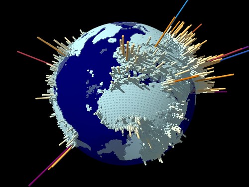
G-Econ (Geographically based Economic data) is a Yale project mapping the location of economic activity.
Using economic data for each 1 degree by 1 degree square of the Earth's surface they have created a series of globes highlighting economic activity across the world.


